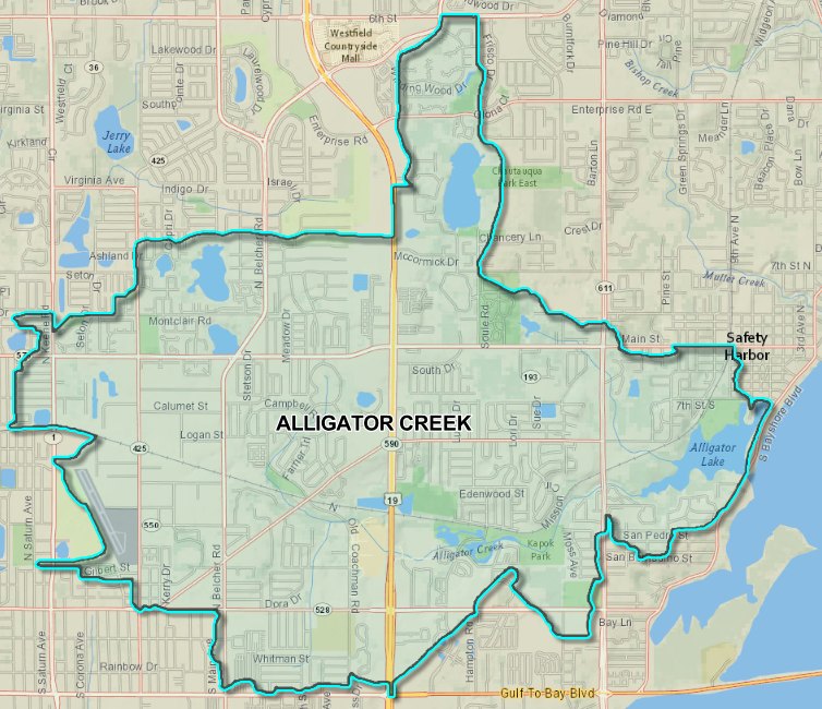
Property owners in and around Clearwater could face new flood insurance requirements after FEMA released preliminary maps that expand the 100-year floodplain in the Alligator Creek Watershed by roughly 415 acres.
The updated maps show approximately 1,390 acres now fall within the 100-year floodplain, up from about 975 acres on the current FEMA maps — an increase of roughly 43%. The changes mean some homes and businesses that previously sat outside the Special Flood Hazard Area may now be inside it.
Once the new FEMA Flood Insurance Rate Map is adopted, property owners newly placed in a high-risk flood zone may be required to purchase flood insurance if they have a federally backed mortgage. Insurance premiums also could change for some properties.
A 90-day public appeal and comment period opens Wednesday, Aug. 19, and closes Nov. 17, giving affected residents an opportunity to dispute the changes before the maps become final.
Why the maps changed
Pinellas County, the City of Clearwater and the Southwest Florida Water Management District commissioned a detailed hydrologic and hydraulic study of the watershed as part of the Alligator Creek Watershed Management Plan.
Engineers used modern LiDAR-based elevation data and divided the watershed into more than 1,000 individual subbasins, providing a much finer level of detail than the broader topographic contours used to develop the existing FEMA maps.
The result: depressions, small lakes and low-lying neighborhoods that older mapping methods did not capture now show up as flood-prone areas.
The Alligator Creek Watershed covers nearly 8.7 square miles of heavily developed land across parts of unincorporated Pinellas County, Clearwater and Safety Harbor. Residential neighborhoods dominate the watershed, which also includes a commercial corridor along U.S. Highway 19.
What residents should do
Property owners can check whether their parcel is affected using the FEMA Flood Map Changes viewer linked on Pinellas County's Alligator Creek Watershed page.
The county recommends that affected property owners contact their insurance agents to discuss potential changes and consider purchasing flood insurance before the preliminary maps are officially adopted.
Properties newly mapped into a high-risk flood zone may qualify for a "newly mapped" flood insurance discount if coverage is purchased within 12 months of the new map becoming effective.
How to appeal
Residents who believe the preliminary maps are inaccurate can file a formal appeal or submit a comment through the online form linked on the county's Alligator Creek Watershed page. The appeal and comment period runs from Wednesday, Aug. 19, through Nov. 17.
For questions, residents can contact Pinellas County Floodplain Management at 727-464-7700 or [email protected].
The county's flood map resources also allow residents to compare FEMA flood zones with other flood-risk information. Federal flood insurance requirements are based on FEMA Flood Insurance Rate Maps rather than separate Pinellas County floodplain maps.






.jpg)